 WARNING: WE ARE UPDATING OUR EQUIPMENT. THIS PAGE MAY BE OUTDATED. PLEASE TUNE INTO THE WEATHER CHANNEL FOR UP-TO-DATE INFO. THE UPDATE IS EXPECTED TO BE COMPLETED BY TOMORROW.

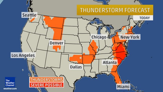
Severe Storms Threaten Long Island
 Click for larger image.
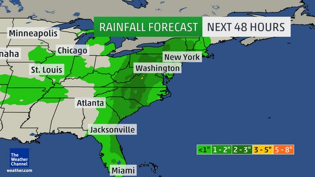
A slow-moving cold front will be the primary feature instigating thunderstorms in the eastern U.S. wrapping up the work week.
 Click for larger image.
While a few severe t-storms are possible, the primary threat for many will be locally heavy rain and flash flooding, as deep moisture originating from the Caribbean Sea and Gulf of Mexico is pulled north ahead of this front.
What We're Watching For Friday:
What We're Watching For Friday:
- Threat of local flash flooding
- Wet commute (a.m./p.m.) with flight delays possible
